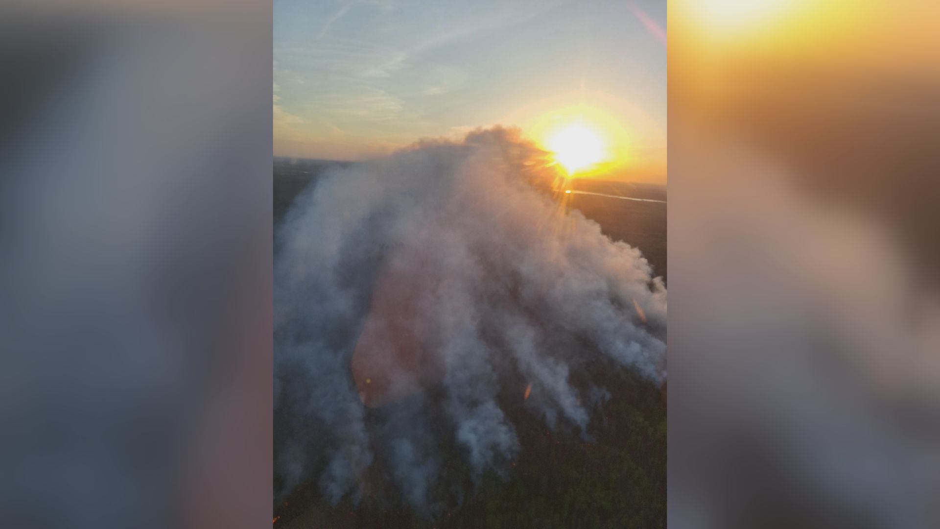
The traditional approach to analyzing Western weather treats wildfire smoke, extreme heat, heavy precipitation, and systemic flooding as isolated, sequential disruptions. This siloed perspective miscalculates the true economic and infrastructural risk. In reality, these atmospheric phenomena operate within a tightly coupled, self-reinforcing thermodynamic feedback loop. By shifting the analytical lens from independent events to a unified cascading system, we can map how a single thermal anomaly escalates into a multi-variable crisis across municipal infrastructure, agricultural supply chains, and regional energy grids.
Understanding this system requires breaking down Western weather into its core structural components: the atmospheric drivers, the surface-level compounding mechanisms, and the downstream vulnerabilities that dictate the regional risk profile. For a deeper dive into this area, we recommend: this related article.
The Thermodynamic Engines Driving Western Weather
Western meteorological volatility is fundamentally governed by three distinct atmospheric frameworks. Each framework alters regional pressure gradients and moisture transport, establishing the baseline conditions for extreme weather.
The Subtropical Ridge and Omega Blocking Patterns
The primary driver of prolonged extreme heat is the intensification of upper-level high-pressure systems, often manifesting as an "Omega block." This configuration stalls weather patterns across the continent, pinning a high-pressure ridge over the Western United States. For further details on this development, extensive analysis can be read on USA Today.
As air sinks within this ridge, it undergoes adiabatic compression, heating the lower atmosphere while systematically repelling the cooler, moisture-laden low-pressure systems originating in the Pacific. The prolonged residence time of these ridges creates a persistent thermal engine, accelerating moisture depletion from both soil and vegetation.
Tropospheric Vapor Transport and Atmospheric Rivers
Conversely, the primary mechanism for extreme precipitation shifted from localized convective storms to massive, highly concentrated corridors of water vapor known as Atmospheric Rivers (ARs). These systems transport moisture from the tropics to the mid-latitudes, frequently carrying a volumetric flow rate that exceeds the mouth of the Mississippi River.
When an AR collides with the complex topography of the West—such as the Sierra Nevada or the Cascade Range—the moisture is forced upward. This orographic lifting causes rapid cooling, condensation, and intense, localized precipitation.
The Arctic Amplification Feedback
The structural behavior of the jet stream is heavily influenced by the diminishing temperature gradient between the Arctic and the equator. As the Arctic warms at an accelerated rate, the zonal velocity of the jet stream decreases. This deceleration causes the jet stream to meander in deeply undulating waves. These highly amplified waves lock extreme conditions—whether intense heat ridges or persistent storm tracks—in place for weeks at a time, removing the historical predictability of seasonal transitions.
The Cascade Effect: Mapping the Interdependencies
To accurately price risk or plan infrastructure, one must analyze how these atmospheric drivers interact on the ground. The transition from a heatwave to a catastrophic flood is not a series of unfortunate accidents; it is a predictable sequence of physical cause and effect.
[Extended Heat Ridge]
       │
       ▼
[Vapor Pressure Deficit Spikes] ──► [Fuel Moisture Depletion] ──► [Wildfire Ignition]
                                                                        │
                                                                        ▼
[Soil Hydrophobicity] ◄── [Ash/Char Deposition] ◄── [High-Severity Burn]
       │
       ▼
[Atmospheric River Influx] ──► [Zero Infiltration] ──► [Debris Flow / Flash Flood]
Phase 1: Vapor Pressure Deficit and Fuel Matrix Transformation
The intersection of extreme heat and low relative humidity is quantified via the Vapor Pressure Deficit (VPD)—the difference between the amount of moisture the air holds and the amount it can hold at saturation. When VPD spikes, the atmosphere acts as a sponge, aggressively drawing moisture out of live and dead vegetation.
This process transforms the landscape into a continuous, highly flammable fuel matrix. The probability of large-scale wildfire ignition becomes less a function of spark sources and more a function of this regional fuel dryness threshold.
Phase 2: Atmospheric Chemistry and Pyrocumulonimbus Dynamics
Once large-scale wildfires ignite, they cease to be passive responders to local weather; they begin to dictate it. High-intensity burns generate immense convective plumes. These plumes inject massive volumes of particulate matter (PM2.5), black carbon, and volatile organic compounds into the troposphere.
Under specific atmospheric conditions, these plumes evolve into pyrocumulonimbus (pyroCb) clouds. These fire-generated thunderstorms produce erratic surface winds, downbursts, and lightning strikes without matching precipitation, self-propagating the fire front and expanding the regional smoke blanket across thousands of miles.
Phase 3: Pyrogenic Soil Hydrophobicity
The critical connection between fire season and flood season occurs at the molecular level within the soil. During high-severity wildfires, the burning of organic matter releases hydrophobic (water-repellent) gas compounds. These gases penetrate the soil profile and condense on cooler soil particles below the surface, creating a discrete, water-impermeable layer.
Phase 4: Orographic Influx and Debris Flow Mechanics
When an atmospheric river subsequently makes landfall over a recently burned watershed, the structural integrity of the drainage basin fails. Because the hydrophobic soil layer prevents normal infiltration, rainfall cannot penetrate the ground. Instead, 100% of the precipitation becomes immediate surface runoff.
This rapid velocity of water shears away the destabilized topsoil, picking up ash, boulders, and downed timber. The resulting debris flow moves with a density and kinetic energy vastly exceeding a standard freshwater flood, obliterating downstream culverts, bridges, and residential developments.
Quantification Matrix: Sectoral Vulnerabilities
The operational impact of these coupled weather phenomena can be classified into three primary economic and infrastructural sectors. Each sector faces distinct operational bottlenecks when these systems activate.
Energy Grid Equilibrium
- The Stressor: Simultaneous regional heatwaves and wildfire smoke blankets.
- The Mechanism: Ambient temperatures above 40°C drastically reduce the transmission efficiency of high-voltage power lines due to thermal resistance, while concurrently driving peak air conditioning demand. Simultaneously, widespread smoke plumes introduce heavy aerosol optical depth, cutting solar photovoltaic (PV) generation by up to 90% in affected zones.
- The Bottleneck: The grid faces a critical supply-demand divergence: maximum load requirement paired with a crippled generation and transmission capacity, forcing reliance on expensive, high-emission peaker plants or rolling blackouts.
Municipal Water and Transport Infrastructure
- The Stressor: Atmospheric river precipitation falling on post-wildfire burn scars.
- The Mechanism: Runoff carrying millions of tons of suspended solids, ash, and heavy metals overwhelms municipal water treatment facilities. The high turbidity prevents standard filtration systems from operating, forcing water districts to bypass storage or shut down intakes entirely. On the transport side, debris flows overwhelm drainage dimensions calculated using outdated historical baselines.
- The Bottleneck: Physical destruction of transit corridors (highways, rail lines) alongside acute regional potable water shortages.
Agricultural Supply Chain Continuity
- The Stressor: Prolonged VPD elevation interspersed with unseasonal, intense precipitation events.
- The Mechanism: Extended high VPD induces severe stomatal closure in crops, arresting growth and reducing yield quality. Conversely, when unseasonal atmospheric rivers dump high volumes of water on parched, compacted soils, it causes root rot, field flooding, and the physical destruction of mature crops ready for harvest.
- The Bottleneck: Structural volatility in crop yields, leading to extreme pricing fluctuations, supply chain disruptions for food processors, and soaring agricultural insurance premiums.
Limitations of Current Predictive Methodologies
Evaluating these risks requires acknowledging the severe limitations built into standard meteorological and economic forecasting tools.
The reliance on historical baseline data—specifically the use of 30-year climate averages to calculate the probability of "100-year" floods or fires—is fundamentally flawed. Because the underlying thermodynamic baseline is shifting, historical frequencies no longer accurately reflect future probabilities. This creates an "unprecedented event" paradox, where infrastructure designed for historical boundaries is systematically exposed to conditions beyond its design parameters.
Furthermore, most predictive models operate in silos. A meteorological model might accurately predict the precipitation volume of an incoming atmospheric river, but if it fails to ingest real-time satellite data mapping the hydrophobicity and vegetative loss of a burn scar from three months prior, its flood-risk output will be undervalued by orders of magnitude.
Operational Blueprint for Resource Management
Mitigating the compounding effects of Western weather requires a shift from reactive emergency response to proactive structural adaptation. Asset managers, municipal engineers, and agricultural operators must deploy a multi-layered defensive strategy.
Grid De-Risking via Distributed Storage and Microgrids
To counteract the dual impact of thermal transmission loss and smoke-induced solar degradation, utilities must decouple critical localized demand from central transmission corridors. This requires installing utility-scale battery storage units directly at municipal substations. These assets can capture surplus generation during clear-sky periods and discharge during peak demand or smoke-induced solar deficits, neutralizing the supply-demand gap.
Watershed Stabilization and Debris Basin Retrofitting
Municipalities downgradient from high-risk or recently burned forest assets must structurally redesign their stormwater networks. Standard concrete culverts must be replaced with open-bottom, high-capacity channels capable of handling high-viscosity debris flows rather than just clear water.
Additionally, engineered debris basins—designed to slow down the kinetic energy of mudslides and filter out large macro-solids before they reach critical infrastructure—must be constructed at the mouths of high-risk canyons.
Agricultural Transition to Controlled Environment Agriculture (CEA) and Deep-Root Cultivation
To insulate food production from volatile VPD swings and unpredictable precipitation, commercial agriculture must strategically shift high-value crop production to semi-controlled or fully controlled environments, such as advanced greenhouses or vertical farming facilities.
For open-field operations, growers must transition to crop varietals engineered for deeper root architectures and higher thermal tolerance. This preserves soil structure during intense rains and maintains moisture access during extended dry periods.
The final strategic requirement is the immediate integration of dynamic, multi-variable risk modeling into all long-term capital allocation plans. Continuing to fund, build, and insure assets based on the assumption that smoke, heat, rain, and flooding are separate, manageable anomalies is an operational dead end. Only organizations that analyze and build for the interconnected reality of the modern climate system will maintain structural resilience.