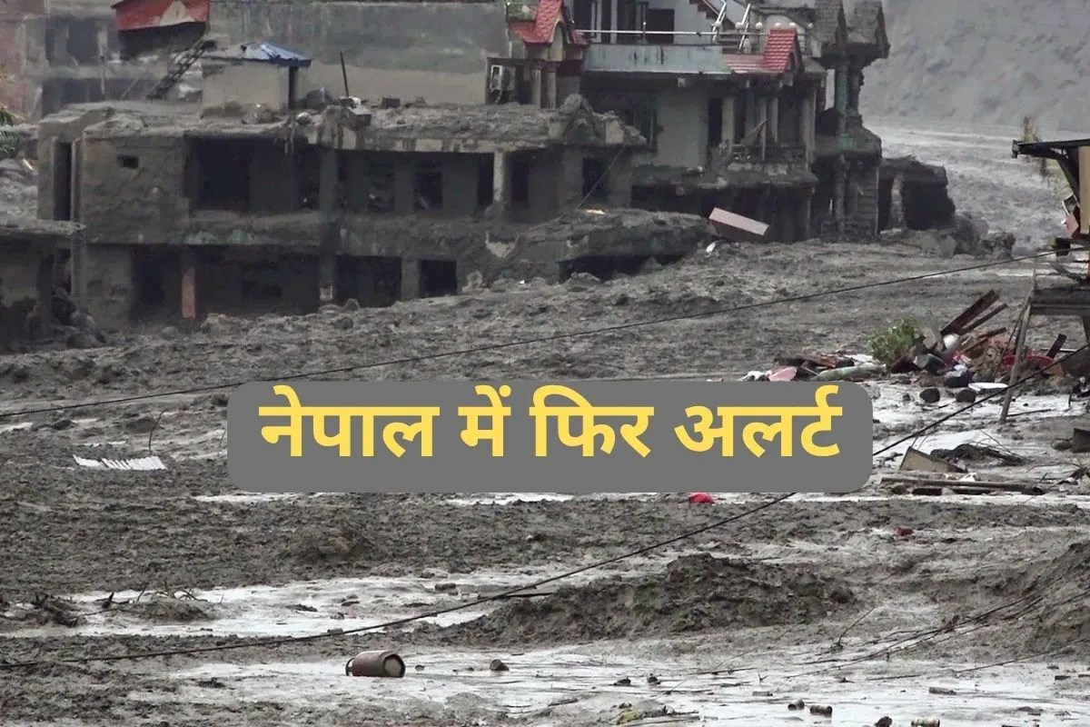
A cascading wall of water, ice, and debris tore down the Bhote Koshi and Trishuli river corridors, transforming Himalayan valleys into disaster zones and forcing frantic evacuations along the Nepal-Tibet frontier. When a high-altitude glacial collapse near the border triggered a natural barrier lake to swell and eventually overflow, downstream communities in districts like Rasuwa and Nuwakot found themselves on the front lines of an unfolding catastrophe. Hundreds remain missing, rescue operations have faced repeated suspensions, and governments are scrambling to manage an escalating humanitarian crisis.
Yet, reducing this disaster to a sudden stroke of bad weather ignores the complex mechanics of Himalayan hydro-geology and the compounding vulnerabilities of trans-boundary river management.
Anatomy of a High-Altitude Failure
The disaster did not begin with ordinary monsoon rainfall. High in the headwaters near the peaks, a massive section of rock and glacier gave way at an elevation exceeding 5,000 meters. The resulting avalanche slammed into the valley floor, briefly damming local tributaries such as the Lhende Khola.
When natural debris dams form under these conditions, they rarely hold. They function as ticking time bombs. As water accumulates behind the unstable wall of sediment and ice, internal pressure builds exponentially.
- The Initial Trigger: The high-altitude mass movement registered on seismic monitors as a significant tremor, masking an ice-rock avalanche as a tectonic event before satellite imagery confirmed the truth.
- The Impoundment Phase: Debris choked the river channel, creating an accidental reservoir holding millions of cubic meters of water.
- The Rupture Event: Once the natural barrier breached, a hyper-concentrated flow of mud, water, and boulders surged downstream, raising water levels by multiple meters in minutes and completely overwhelming local infrastructure.
Engineers and geomorphologists have long warned that warming temperatures in high-mountain Asia are destabilizing steep slopes. Glaciers retreat, leaving unsupported rock walls vulnerable to collapse. When these failures occur directly into narrow gorges, the downstream human toll is almost instantaneous.
The Trans-Boundary Information Gap
Managing disasters across international borders requires absolute transparency and real-time data sharing. When the barrier lake on the Tibetan side began overflowing, triggering secondary safety alerts, rescue teams on both sides of the border had to scramble. Heavy machinery was pulled back, personnel were ordered to higher ground, and search efforts inside hydropower tunnels and debris fields came to a grinding halt.
Communication lags between upstream authorities and downstream populations amplify the danger. Early warning systems in remote Himalayan gorges are sparse, leaving communities heavily reliant on visual confirmation or delayed official bulletins. By the time an alert travels down the valley, the muddy torrent is often already breaching local defenses.
This structural vulnerability exposes the friction points in regional disaster response. Hydropower projects dotting the Trishuli and Bhote Koshi basins—designed to harness rapid river drops for energy—frequently find themselves directly in the path of glacial outburst floods. Tunnels meant to channel water for turbines instead trap workers when sudden surges block exits and overwhelm internal drainage.
Infrastructure and the Human Cost
The economic and human fallout extends far beyond local settlements. Major highways connecting Nepal to regional trade hubs have been severed by landslides, isolating mountain communities and complicating the delivery of medical supplies and portable generators. Foreign tourists, pilgrims headed toward high-altitude routes, and local laborers form a complex demographic among the missing and displaced.
Search and rescue teams face near-impossible working conditions. Thick layers of silt bury roads, bridges, and market areas, turning recovery operations into grueling excavation tasks. Military helicopters provide the primary lifeline for ferrying survivors out of isolated pockets, but low-hanging cloud cover and unstable atmospheric conditions frequently ground air support.
As water levels fluctuate and secondary barrier lakes continue to threaten downstream districts, authorities maintain high alert statuses along the riverbanks. The immediate priority remains securing human life and evacuating remaining pockets of residents from high-risk flood zones. Yet the broader reality persists that the roof of the world is changing faster than regional safety architecture can adapt, leaving millions downstream to contend with the growing volatility of the mountains.