The construction of the Medog Hydropower Station on the lower reaches of the Yarlung Tsangpo River altered the geopolitical equilibrium of South Asia. Initiated on July 19, 2025, by the Power Construction Corporation of China, this $137 billion to $168 billion megaproject is engineered to capture the immense kinetic potential of the world’s deepest canyon. Armed with a planned capacity of 60 gigawatts (GW) and an annual output target of 300 billion kilowatt-hours, the installation will generate triple the energy of the Three Gorges Dam.
For downstream riparians—specifically India and Bangladesh—the strategic risk profile of this infrastructure cannot be measured by aggregate volumetric water loss alone. Instead, the challenge manifests through three distinct vectors: structural flow manipulation, sediment retention mechanics, and localized seismic vulnerability.
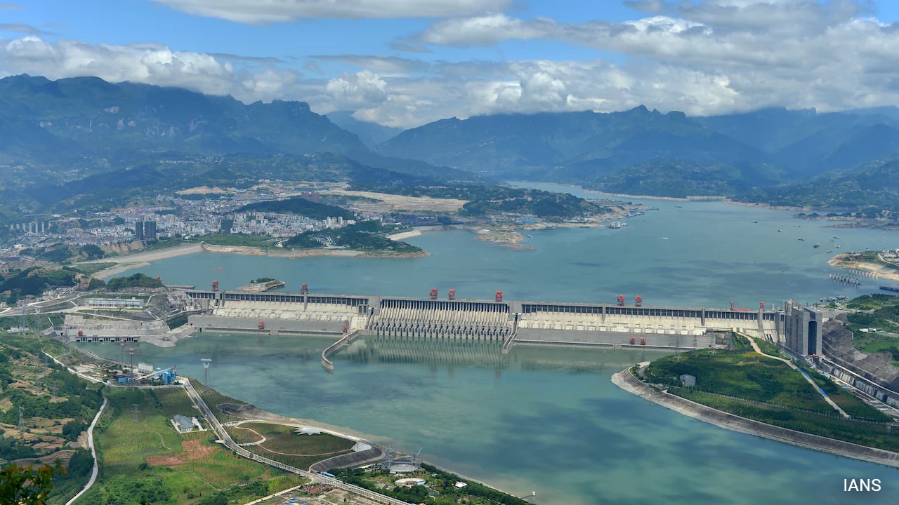
The Mechanics of Kinetic Capture: The Five-Dam Cascade
The core engineering thesis of the Medog project relies on topography rather than sheer reservoir volume. Where the Yarlung Tsangpo circumscribes Mount Namcha Barwa at the "Great Bend," the river drops approximately 2,000 meters in altitude across a horizontal span of just 50 kilometers.
To exploit this geographic anomaly, the project utilizes a loop-straightening diversion mechanism:
- The Headworks: A primary regulatory dam intercepts the river near Pe Town in Mainling County.
- The Conveyance Tunnels: Water is diverted into a series of sub-surface tunnels driven through the mountain massif, bypassing the natural horseshoe curve of the canyon.
- The Power Cascade: The system deploys five cascade power stations embedded within the tunnel network, maximizing the head pressure generated by the 2,000-meter drop.
- The Tailrace Discharge: The water enters the natural riverbed at Medog County, immediately upstream of the Line of Actual Control (LAC) separating China from India's Arunachal Pradesh.
This run-of-the-river design implies that water is not permanently removed from the system; it is diverted, ran through turbines, and returned downstream. The primary hydrologic disruption occurs because the cascade requires substantial operational water volumes to run efficiently. During dry winter months, maintaining peak power generation requires upstream retention to maximize head pressure. This dynamic forces an artificial alternation between absolute retention and sudden discharge, severely destabilizing downstream flow patterns.
The Asymmetry of Volumetric vs Seasonal Flow
A common analytical error is evaluating the threat to India based solely on annual discharge calculations. Hydrological data confirms that 65% to 70% of the Brahmaputra River’s final volumetric flow is generated south of the Himalayas within Indian territory, driven by intense monsoonal precipitation and feeding tributaries in Assam and Arunachal Pradesh.
The upper Tibetan catchment area contributes a minority share of the total annual volume. This baseline statistic leads some commentators to assume the downstream risk is negligible. This view ignores the seasonal variance function:
$$\text{Seasonal Vulnerability} = \frac{\Delta \text{Flow}_{\text{Dry Season}}}{\text{Total Downstream Utilization}}$$
During the pre-monsoon and dry winter months (November to April), the melting glaciers of the Tibetan Plateau constitute up to 40% of the river’s flow in the upper plains of Assam. By controlling the headwaters during these critical months, the upstream operator gains structural control over agricultural irrigation cycles in Northeast India. The threat is not the complete drying of the Brahmaputra, but rather the creation of acute seasonal water scarcity, juxtaposed against the risk of uncoordinated, high-volume discharges during the summer monsoon that exacerbate regional flooding.
Sediment Kinetics and Downstream Agricultural Degradation
The geological impact of the Medog cascade presents an immediate threat to the agrarian economy of the Brahmaputra valley. The Yarlung Tsangpo Grand Canyon is a highly active erosional zone. The rapid descent of the river strips immense volumes of silt from the canyon walls. Research indicates that this single 50-kilometer stretch supplies up to 45% of the total sediment load carried by the Brahmaputra into India and Bangladesh.
When water is routed away from the natural canyon floor through smooth, concrete-lined diversion tunnels, the flow velocity inside the natural riverbed drops to near zero during non-flood periods. This drop halts sediment transport. The downstream consequences follow a clear causal chain:
- Reservoir Siltation: The heavier sand and nutrient-rich silt settle behind the upper regulatory barriers in Tibet, degrading the project's long-term storage capacity.
- Hungry Water Degradation: Water discharged from the tailrace tunnels is stripped of its sediment load. This clear, sediment-starved water possesses high kinetic energy but low particle density, causing it to aggressively erode riverbanks and downstream channel beds in Arunachal Pradesh and Assam.
- Nutrient Deprivation: The floodplains of Northeast India and Bangladesh rely on annual silt deposition to replenish soil nitrogen, phosphorus, and potassium. Halting this sediment transfer undermines the food security of millions of downstream farmers.
Tectonic Volatility and Reservoir-Induced Seismicity
The construction zone is situated directly over the collision front of the Indian and Eurasian tectonic plates. The intersection of the Tsangpo and Eurasian-Indian suture zones makes this region one of the most seismically volatile zones on Earth, characterized by historical events like the 1950 Medog earthquake (magnitude 8.6).
Building a multi-dam infrastructure complex in this geological setting introduces two systemic risks:
- Reservoir-Induced Seismicity (RIS): The immense weight of water stored behind the primary regulatory dams exerts massive hydrostatic pressure on local fault lines. This pressure alters pore fluid pressure within tectonic fractures, risking the triggering of high-magnitude earthquakes.
- Landslide-Induced Dam Failure: The steep slopes of the Yarlung Tsangpo Grand Canyon are highly prone to massive landslides. A major landslide entering a reservoir would generate a displacement wave capable of overtopping or destroying the concrete gravity structures, sending a catastrophic wall of water directly into India's low-lying downstream plains.
Counter-Buffering: India's Strategic Hydro-Defense
India possesses no formal, binding water-sharing treaty with China, leaving it without international legal recourse to halt the project. Bilateral engagement remains limited to basic, non-binding Expert-Level Mechanisms for seasonal flood data exchange.
To counter this structural disadvantage, New Delhi has shifted toward a strategy of defensive hydro-tactics. The central pillar of this response is the revival of the Siang Upper Multipurpose Project (SUMP) in Arunachal Pradesh.
Designed as an 11,000-megawatt (11 GW) installation, SUMP is placed strategically downstream of the Chinese tailrace discharge points. The objective of this project is not primary power generation, but rather the creation of a massive volumetric buffer.
By constructing a large-capacity reservoir just inside Indian territory, India establishes a mechanism to absorb sudden, unannounced water releases from the Chinese cascade, preventing flash floods in Assam. This reservoir will store water during periods of upstream Chinese retention, ensuring a steady, regulated supply to downstream regions during the dry winter season.
This counter-strategy carries substantial domestic liabilities. The construction of SUMP will submerge vast areas of indigenous land in Arunachal Pradesh, alter local ecosystems, and lock India into a competitive, capital-intensive race to dam the same river system. This defensive build-out highlights how transboundary water resources are shifting from shared ecological assets into instruments of geopolitical deterrence.


