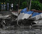
Geopolitical trade corridors constructed in high-altitude mountain zones contain structural vulnerabilities that traditional risk models routinely underestimate. When catastrophic natural forces collide with concentrated border logistics hubs, the resulting systemic failure extends far beyond immediate property damage. Analyzing the recent disaster at the Gyirong Port crossing along the China-Nepal border reveals how complex topography, interdependent supply chains, and high-density transit nodes create severe systemic risk multiplication.
The Mechanics of Topographical Failure
The event at the Himalayan border began with a high-magnitude geomorphological shift—specifically, a massive rock and ice slide approximately twenty kilometers north-east of the border checkpoint, which instantly triggered cataclysmic flash floods along the Bhote Koshi river corridor. Standard risk analysis treats border infrastructure as a static engineering problem solved by concrete retaining walls and reinforced asphalt. However, mountain drainage basins operate as dynamic energy systems.
When a multi-ton debris mass obstructs a high-velocity alpine channel, it creates an unannounced temporary dam. The subsequent breaching of this natural barrier generates a high-density hyper-concentrated flow capable of moving boulders, uprooting deep-rooted timber, and carrying industrial transport trucks like debris.
- The Energy Accumulation Phase: Steep gradients concentrate gravitational potential energy into kinetic energy within minutes.
- The Channel Constriction Point: Narrow gorges amplify the wave height and velocity, turning ordinary riverbeds into destructive battering rams.
- The Asset Concentration Effect: Border ports require flat river valleys for administrative buildings, customs yards, and warehousing, placing high-value assets directly inside the most hazardous hydraulic path.
This dynamic explains why traditional flood mitigation measures failed entirely at the Gyirong crossing. The disaster did not arrive as rising water; it arrived as an instantaneous wave of mud, rock, and water that liquidated buildings and communications infrastructure within seconds.
The Logistics Collapse Function
Modern trade routes linking South and East Asia rely heavily on concentrated overland arteries. Gyirong Port functions as the primary dry port and trade gateway between Tibet and Nepal, handling heavy commercial freight, electrical equipment, and consumer goods. When a choke point of this magnitude experiences total physical severance, the economic damage function multiplies across three distinct operational tiers.
First, physical isolation occurs instantaneously. The destruction of approach roads, bridges, and power lines isolates security posts, customs facilities, and civilian populations simultaneously. Heavy machinery cannot reach the site because the infrastructure required to transport the equipment has been washed away.
Second, real-time coordination breaks down. Communications arrays and electrical grids fail at the onset of the impact, plunging rescue command centers into informational blindness. Without telemetry or cellular feedback, state planners must deploy reconnaissance assets blindly, delaying the deployment of specialized medical and search units.
Third, regional supply chains experience immediate throughput halts. Commercial transit fleets stranded near the frontier cannot reverse direction due to narrow mountain passes and blocked tunnels. The cost function shifts from delayed shipments to permanent asset write-offs, evidenced by the hundreds of commercial transport vehicles buried or swept downstream.
Human Capital and Multi-Jurisdictional Friction
Logistical nodes in border zones are densely populated by distinct demographic cohorts with disparate emergency responses: customs personnel, military border guards, commercial transport operators, and international travelers or religious pilgrims moving toward sacred sites like Mount Kailash. The convergence of these groups inside a narrow river corridor maximizes human vulnerability.
When a disaster spans an international demarcation line, administrative friction impedes rescue efficacy. Search and recovery operations must navigate separate bureaucratic protocols, distinct communication channels, and varying jurisdictional command structures. While local authorities on the northern side of the border reported restricted initial casualties alongside extensive missing person counts, downstream sectors across the southern boundary recorded massive fatalities carried kilometers away. This disparity highlights a critical gap in cross-border disaster management: the absence of unified telemetry sharing between neighboring states sharing the same river basin.
Strategic Operational Redirection
To mitigate future high-altitude logistical catastrophes, planners must abandon reactive reconstruction models and adopt absolute geographic redundancy. Rebuilding administrative hubs and dry ports directly within narrow Himalayan river valleys invites repeated systemic failure.
Supply chain architectures across high-risk mountain borders require decentralized staging areas located outside primary hydraulic disaster zones, coupled with satellite-linked emergency sensors positioned upriver to provide automated early-warning telemetry before kinetic impact occurs.